

The hike begins after a nice climb up from the parking lot on an old wagon road through relatively flat Horsethief Park. Unfortunately you are on the less attractive side of the park (although the shade from the trees is nice)–the creek and beaver dens are all on the left. The Ring the Peak Trail runs left off this trail and offers the prettier view of the park, but this trail stays in the trees. At 0.7 miles there is a large difficult-to-miss sign pointing out the junction between the trails to Horsethief Falls and Pancake Rocks. Adults and older kids could easily do both in a day, but my recommendation for young elementary schoolers would be to keep the two hikes separate, or at the very least, do Pancake Rocks first and if after that the kids were up to seeing Horsethief Falls on the way out, great. At this point in the hike, things get real. You’ll gain 800ft of elevation over the next mile of switchbacks through the trees. At the top there’s a great spot for a rest (unless you’re trying to beat a thunderstorm like we were)! There is a fire spot and enough level area for a great backpacking site, however it is a long hike down to the water. There is a nice flat section before you drop down (argh) and then up again (double argh).
Pros: This was a great hike to put my little hikers to the test! It was not very crowded once you get onto the Pancake Rock section, had nice variety, and the namesake rocks a the end of the hike were a nice pay-off.
Cons: I like my hikes to be predictable. I like my ups to go up and my downs to go down. This one is emotionally trickier–there’s a significant little descent on your way up (elevation you then have to gain back). There is also very little water along the hike.
Distance/Difficulty: This is the most challenging hike we’ve done as a family. At 6.4 miles and 1400ft elevation gain at 10,000ft, you are going to be trying to suck down some oxygen and wondering where it is! We’d prepped the kids that this would be a challenge, but three quarters of the way up the steep switchback section, as I was huffing and puffing, Ellie piped up with “when’s the hard part going to be?” I think what made it such a success in spite of her tiny legs is that she’d been hiking all season with a camelback full of water, but we’d left that at our campsite to lighten her load for this longer/harder hike. It was a very successful strategy!
Directions: This hike couldn’t be easier to find. Take US24 to Divide, then take US67 south for 9.3 miles. You’ll find the trailhead easily around a bend in the road, at it is notable for its large parking area next to an old tunnel.
Trail Teaching:
- Pancake rock formation–for all of my books and internet research, I actually couldn’t find a good explanation of how the granite pancake rocks formed. There are explanations online about limestone pancake rock formations, but the internet geology buffs go silent when it comes to granite pancake rock formations. So have the kids use what they know about geological forces to make guesses.
- Area history-the guidebooks make vague references to Horsethief Park’s “colorful history,” and a few blog posts explain that the park received its name from the thieves who lived there and stole from the gold camp travelers. From Pancake Rocks you can look out to see the giant American Eagles Mine and talk about the history of mining in Cripple Creek. US-67 runs along the old railroad bed that ran to Cripple Creek. According to Roadside Geology of Colorado, Cripple Creek produced $450 million in gold and silver from 1891-1942.
Photos
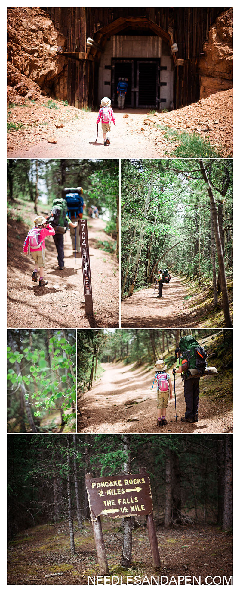
This series shows pictures from the beginning of the hike, starting with the old tunnel and trailhead and ending with the trail junction that marks the start of the switchbacks.
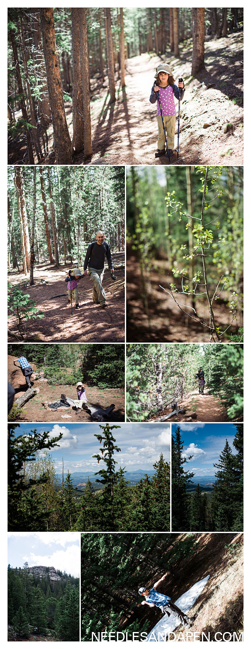
Up the switchbacks to a little campsite at a great overlook spot before a nice flat section and then a steep descent before your final ascent to the pancake rocks. This area of the trail had some summer snow for snowballs!

The pancake rocks themselves and view toward the American Eagle Mine (the brown hillsides on the horizon).
Further Reading: Great pictures from a late season hike on this blog and a thorough trail review here. If you’re interested in adding on Horsethief Falls to this hike, here is my post on Horsethief Falls.
![]()